on-this-day · august 3

landing of columbus, 1492. source: wikimedia commons
The Journey That Remade the World
On this day in 1492 — Columbus set sail from Spain. Navigation as design, with terrible consequences.
3 min read
On August 3, 1492, three ships left the port of Palos de la Frontera in southern Spain. The Santa Maria, the Pinta, and the Niña carried a crew of about ninety men, provisions for several months, and a navigation plan based on a fundamental miscalculation. Christopher Columbus believed the Earth was smaller than it actually is. He thought the distance from Europe to Asia, sailing west, was about 2,400 nautical miles. The real distance is over 12,000 miles. If the Americas hadn't been in the way, his entire crew would have starved to death in the middle of the ocean.
Columbus was not trying to discover a new world. He was trying to find a shortcut to the old one. The spice trade with Asia was enormously profitable, but the overland routes were controlled by the Ottoman Empire and Venetian merchants. Spain and Portugal were looking for alternative paths. Portugal was sailing south around Africa. Columbus proposed sailing west. He pitched the idea to the Spanish crown for years before Queen Isabella finally agreed to fund the expedition. It was a speculative venture, a calculated risk built on questionable math and optimistic assumptions.
The voyage itself was an exercise in navigation under uncertainty. Columbus used dead reckoning, celestial navigation, and a magnetic compass, tools that had been refined over centuries but were still imprecise. He kept two logs: one accurate, for himself, and one falsified, for the crew, to prevent panic as the days at sea stretched longer than expected. When land was finally sighted on October 12, Columbus believed he had reached the East Indies. He called the people he met Indians, a misnomer that persists to this day.
He had not reached Asia. He had reached the Bahamas, and later Cuba and Hispaniola. The islands were populated by the Taino people, who greeted the Europeans with curiosity and hospitality. Columbus wrote in his journal that they would make excellent servants and could easily be converted to Christianity. Within a few decades, the Taino population would be nearly wiped out by disease, forced labor, and violence. The encounter Columbus initiated set in motion a cascade of ecological, cultural, and demographic catastrophes that reshaped entire continents.
The design of the voyage was sound in technical terms. The ships were well-built caravels, maneuverable and capable of long ocean crossings. The navigation tools worked as intended. The crew was experienced. But the system Columbus set in motion, the Columbian Exchange, as historians call it, was a design failure at a civilizational scale. Crops, animals, diseases, and people moved between hemispheres in ways that permanently altered ecosystems and societies. Europe gained potatoes, tomatoes, and corn. The Americas received smallpox, measles, and slavery.
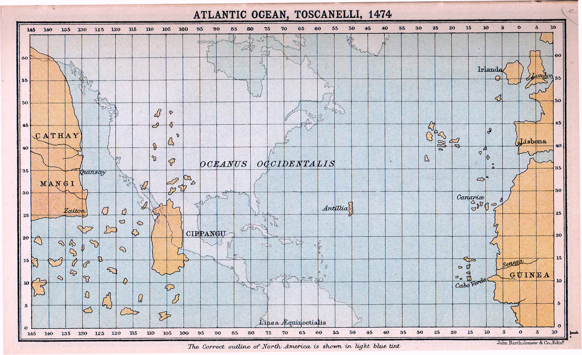
a reconstruction of toscanelli's 1474 map, which placed asia just a short sail west across the atlantic. columbus's voyage rested on this same miscalculation of the earth's size. source: wikimedia commons
Columbus made four voyages to the Americas, never once acknowledging that he had found a continent unknown to European mapmakers. He died in 1506, still believing he had reached Asia, frustrated that he had not been granted the titles and wealth he felt he deserved. The Americas were named after Amerigo Vespucci, an Italian explorer who recognized that the lands Columbus had visited were not part of Asia but a distinct landmass. Columbus got the credit, but not the name.
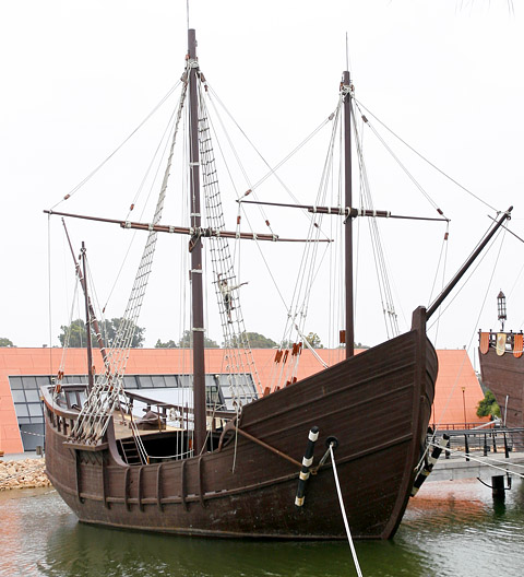
replica of the pinta, one of the three ships columbus sailed from spain on august 3, 1492. source: wikimedia commons
What Columbus designed was a route. What he unleashed was a transformation. The voyage on August 3, 1492, was a technical achievement in seamanship and navigation. It was also the beginning of a process that would destroy entire cultures, introduce chattel slavery to the Western Hemisphere, and create the global economy as we know it. Navigation is neutral. The map is just lines on paper. But the journey those lines describe can change everything. Systems have consequences, and sometimes those consequences are irreversible.